Upstream-downstream politics: South Asia’s water discourse
Reading Time: 8 minutesEditor's Note
Sambandh Scholars Speak, part of the Sambandh: Regional Connectivity Initiative, is a series of blog posts that feature evidence-based research on South Asia with a focus on regional studies and cross-border connectivity. The series engages with authors of recent books, articles, and reports on India and its neighbouring countries. This series is edited by Saneet Chakradeo, Research Analyst at Centre for Social and Economic Progress (CSEP).
In this edition, Riya Sinha interviews Sunil Amrith on his book Unruly Waters: How Mountain Rivers and Monsoons Have Shaped South Asia’s History, first published in December 2018.
Compared to identity politics, water as a source of geopolitical tension in South Asia has received scant attention. On the one hand, the Indus Water Sharing Treaty (1960, India-Pakistan) and the Ganges Water Sharing Treaty (1996, India-Bangladesh) are examples of sustained water cooperation in the region; on the other, treaties such as the one concerning Teesta River and Feni River (India-Bangladesh) remain to be concluded despite decades of discussions. During the recent Prime Ministerial-level talks between India and Bangladesh, while both countries were able to move forward on matters of trade and connectivity, no conclusion could be reached on water-sharing agreements.
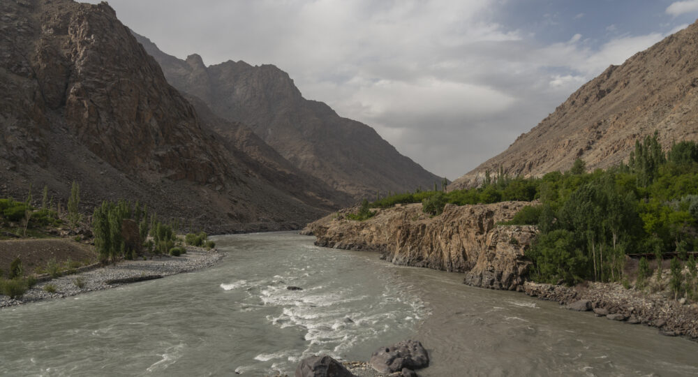
Ten Himalayan rivers sustain one-fifth of the global population across the Indian subcontinent and China. These ten rivers are the Tarim, the Amu Darya, the Indus, the Irrawaddy, the Salween, the Mekong, the Yangzi, the Yellow River, the Ganges, and the Brahmaputra. Water has connected civilisations and impacted culture and politics in the region, leading to attempts over its control and management.
In Unruly Waters, Amrith turns to history to highlight South Asia’s vulnerability to climate change. He places water at the heart of cultural and political transformations in India, arguing that the demographic weight of India and China is an outcome of the control of water rather than a fact of nature (p 5). He departs from the traditional view of water as a resource and highlights the effects of institutions, technologies, and economic pressures on water. Even as the book offers readers a history of water management in different eras, it emphasises that water control can never be purely technical or scientific, or done through one national model. Local histories and culture, too, play an important role in facilitating our understanding of the climate and mountains that shape Asia.
The book is extensively researched and based on archives collected from the United Kingdom, World Bank Group, and the national and state archives in India. It places the reader between the past and the future, necessitating a deeper inspection of how an unequitable and unsustainable race towards constructing water control infrastructure in the Himalayas can leave millions vulnerable.
Riya Sinha: To think of Asia as an ‘integrated climatic system’ (p 108) is to provide an alternative understanding of connectivity in the region. Do you think that due to a higher focus on physical border infrastructure, such as fences, roads, railways etc., states have overlooked the impact of water on regional connectivity?
Sunil Amrith: I think the key to the paradox in your question lies in the fact that the kind of regional connectivity that water provides, has not been the kind of connectivity that modern states and economies rely on—that is to say regular, predictable, and ordered connectivity. British colonial officials and Indian engineers alike saw South Asia’s climate and its rivers as untamed and somehow “wild” (hence the title of my book, “Unruly Waters”). What followed, especially from the late nineteenth century, was a long quest to try to bring water under orderly control through a programme of massive infrastructural engineering.
Yet there always remain important ways in which water connects. One is imaginative: rivers, and the monsoon itself, have long been central to the fabric of people’s spiritual geographies, or the ways they imagine how distant places are connected. These imaginations may—though they do not always—transcend borders. Another way that water connects, especially in an era of accelerating climate change, is through shared risk. At a moment when a sense of solidarity and regional cooperation are vital in the face of environmental crisis, it may be helpful to remember both of these aspects of connectivity
Taking a long-term view, I think we can see there has been a century-long tug between the confidence that water could be brought under control by infrastructure, and a sense—expressed by environmentalists, of course, but even by more cautious engineers and planners—that this is bound to be a losing battle; or at least that “victory” would have many unwanted consequences.
RS: In John Eliot’s Climatological Atlas for India (1906) the maps were limited to British India, despite acknowledgement of the oceanic and inter-continental linkages in climate change. How do such colonial limitations of record-keeping affect the way we think about connectivity in the subcontinent today?
SA: There were two key motivations for the development of climate science in India in the nineteenth century. The first was imperative to understand, and ideally to forecast, extreme weather—especially cyclones. A lot of this was connected with the interests of shipping, in an era when India’s exports were commercially vital to British power. A lot of the earliest data through which scientists began to piece together the patterns of the monsoon were ship’s logs. The second imperative, which grew more urgent as the British colonial state intervened ever more in Indian agriculture, was the need to understand longer-term patterns of average rainfall, the average dates of monsoon onset, and the periodicity of drought. After the massive famines of the 1870s and 1890s, the latter concern prevailed, particularly as steam ships, which began to dominate through those same decades, were less dependent than sailing ships on the winds, and more able to withstand storms.
Telegraphic communication allowed British meteorologists to begin to track storms in “real time,” as we would say now. And the maps of these storms were truly trans-regional, linking the Bay of Bengal with the South China Sea. However, the search for the patterns and regularity of India’s climate—as in Eliot’s atlas—focused much more on the Indian subcontinent as a bounded region. Remember that this took place alongside a whole raft of other changes, all of which cemented the idea of India as a bounded territory and economy (Manu Goswami wrote an excellent book on this called Producing India)—these changes included the infrastructure of the railway, and the colonial government’s statistic apparatus.
I think here, again, we are faced with a paradox: on the one hand, colonial record-keeping allowed, for the first time, the scale of climatic connections to emerge, and the early work of British Indian meteorologists played an important role in the eventual discovery of the El Nino phenomenon (which happened in the 1960s). On the other hand, the colonial state’s way of gathering data also made India appear, more and more, as a self-contained territory, losing sight of those interconnections.
RS: In Chapter 4, you refer to William Hunter’s observation that ‘natural frontiers became synonymous with the security of the realm’ (p 111). Furthermore, you highlight that the ‘data concerning the hydraulics of the Himalayan rivers are a closely guarded secret” (p 321). Compared to other regions globally, why is water treated as a security issue in South Asia rather than a facilitator of connectivity?
Partition divided both of India’s great river basins, the Indus and the Ganga, and so control over water has—from the outset, in 1947—been seen in relation to national sovereignty.
SA: I think a lot of the answer lies in geopolitics. India was central to British power in the world, and in the nineteenth century the colonial state was obsessed with (real or imagined) threats to British primacy in India—in particular from the Russians overland, but also from other European powers at sea. Hunter and others saw water as a strategically important resource. The security-oriented view of water, which you identify in your question, dates back from that moment in the 1870s or 1880s. But I think this was hugely intensified by Partition, and more broadly by the contested borders of the postcolonial settlement across Asia. Partition divided both of India’s great river basins, the Indus and the Ganga, and so control over water has—from the outset, in 1947—been seen in relation to national sovereignty. The Indus Treaty, signed in 1960, has attempted to hold potential conflicts at bay, with not insignificant success, though it always seems fragile. More recently, the Himalayan rivers have become the focus of security-related concerns. One of the things that surprised me most, when I was researching Unruly Waters, is how recent a development this is. Back in the 1950s and 1960s, even top-secret correspondence within the Indian MEA dismissed the possibility that water could become a source of conflict with China. Only with the technological, economic, and demographic shifts of the 1980s did it become viable to engineer the upper reaches of the Himalayan rivers, and thus for those mountain rivers to become a strategic flashpoint.
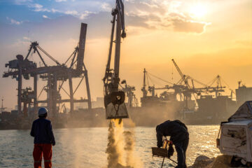
RS: In the Bay of Bengal region, plans are now afoot to use inland waterways and coastal shipping as eco-friendly modes of transportation. Yet, these involve high environmental risks, for instance in the Sundarbans. Do you think this mode of transportation is sustainable in the region? How can regional institutions prioritise environmental issues in development projects?
We should not see connectivity, in and of itself, as positive or negative. The questions we should be asking are: connectivity for what purpose, and in whose interests?
SA: There is no question that inland waterways have been neglected across the region for most of the period since independence; they have been given much less emphasis in policymaking than showpiece infrastructural projects like highways. Yet they have long been central to the livelihoods of fishing communities and many others. Plans to develop them now, however, come with huge ecological risks to already fragile environments. We should not see connectivity, in and of itself, as positive or negative. The questions we should be asking are: connectivity for what purpose, and in whose interests? One recent report suggests that 97% of water traffic between India and Bangladesh is for the transportation of fly ash: a highly toxic by-product of coal production. In 2020, at least five ships carrying fly ash capsized in the Bengal delta, devastating marine life, and creating hazardous conditions for local communities. To the extent that waterway development aims towards furthering such dangerous trades—the transport of fly ash from India to Bangladesh is a perfectly legal but highly unethical form of toxic waste dumping—both ethical and environmental considerations suggest caution.
RS: Supported by public, private, and multilateral institutions, more than five hundred dams have been planned in the Himalayan region of Nepal, India, Bhutan, Pakistan, and China (p 300). This renders the lower riparian areas, particularly in North-east India and Bangladesh, vulnerable. Why have investments in dam building increased in recent years despite the public knowledge about their negative impact?
SA: We saw with the tragic, but all too predictable, dam collapse in Uttarakhand earlier this year that dam projects proceed recklessly, with little heed to the repeated warnings of environmentalists, judges, and above all local people. Soon after the disaster, the chief minister of the state was quick to point out that he hoped it would not encourage people to take an “anti-development” stance. Ever since the rise of environmental movements across South Asia in the 1970s, government officials and corporate leaders have sought to discredit their concerns as “anti-development”. Even to this day, large dams retain some of the symbolic power that they gained in the 1950s, when Nehru called them the “new temples of India”.
The values that should guide water policy, especially in light of climate change, are humility, precaution, and equity.
One of the things that makes the situation in the Himalayas so fraught with danger is that almost every country in the region is pursuing the same brand of reckless development, often in a competitive way. And if you follow their financing, these projects are also connected across borders. Both Indian and Chinese interests are very much involved with such projects throughout the region.
I think the fundamental problem is one of technological hubris: we have never shaken the mid-twentieth century faith that technology would ultimately master nature, despite the mounting toll of evidence that this can never be the case. Across the region, the environmental movement’s longstanding emphasis on the importance of respect for local voices and local ecology, has never been more relevant. I think the values that should guide water policy, especially in light of climate change, are humility, precaution, and equity.
About the expert
 Sunil Amrith is the Renu and Anand Dhawan Professor of History at Yale University, and current Chair of the South Asian Studies Council. He is the author of four books, including Unruly Waters (2018) and Crossing the Bay of Bengal (2013). Amrith is a 2017 MacArthur Fellow, and recipient of the 2016 Infosys Prize in Humanities. Email: sunil.amrith@yale.edu
Riya Sinha

Find on this page
The Centre for Social and Economic Progress (CSEP) is an independent, public policy think tank with a mandate to conduct research and analysis on critical issues facing India and the world and help shape policies that advance sustainable growth and development.