
1. Open the Database and Map
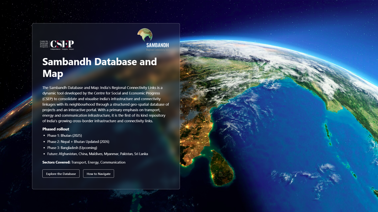
From the landing page, select “Explore the Database” to open the platform.
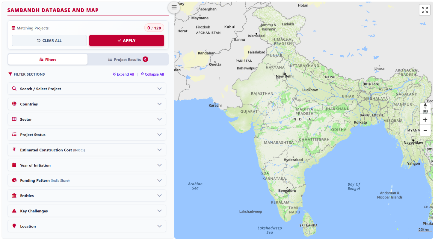
Platform Interface
The platform interface has three parts: Filters, Project Results, and Map. When the platform opens, the filter panel appears on the left and the map on the right, with no projects displayed initially. The total number of projects and the estimated number of matching results are displayed at the top.
Use the expand or collapse option to open or close all filters. Choose your filters, then select “Apply” to display the matching projects.
2. Choose Your Filters
Use the filter panel to narrow the projects you want to explore. Sambandh 2.0 supports filtering by countries, sectors, project status, funding patterns, timelines, key actors, key challenges, and locations. Choose the available options that match your research question, then select “Apply” to display the results.
- Search / Select Projects: Find projects by name or unique project code, or select them from the list
- Countries: Focus on a country covered in the available database
- Sectors: Explore Transport, Energy, or Communication projects
- Project Status: Narrow the selection by the status recorded for each project
- Estimated Construction Cost: Select projects within a chosen estimated construction-cost range
- Year of Initiation: Select projects by the initiation year of a particular project phase
- Funding Patterns: Examine the financing information recorded for projects
- Timelines: Explore projects by their recorded timelines
- Key Actors: Focus on the organisations and entities involved
- Key Challenges: Examine recorded implementation challenges
- Locations: Explore projects in a selected geographic area
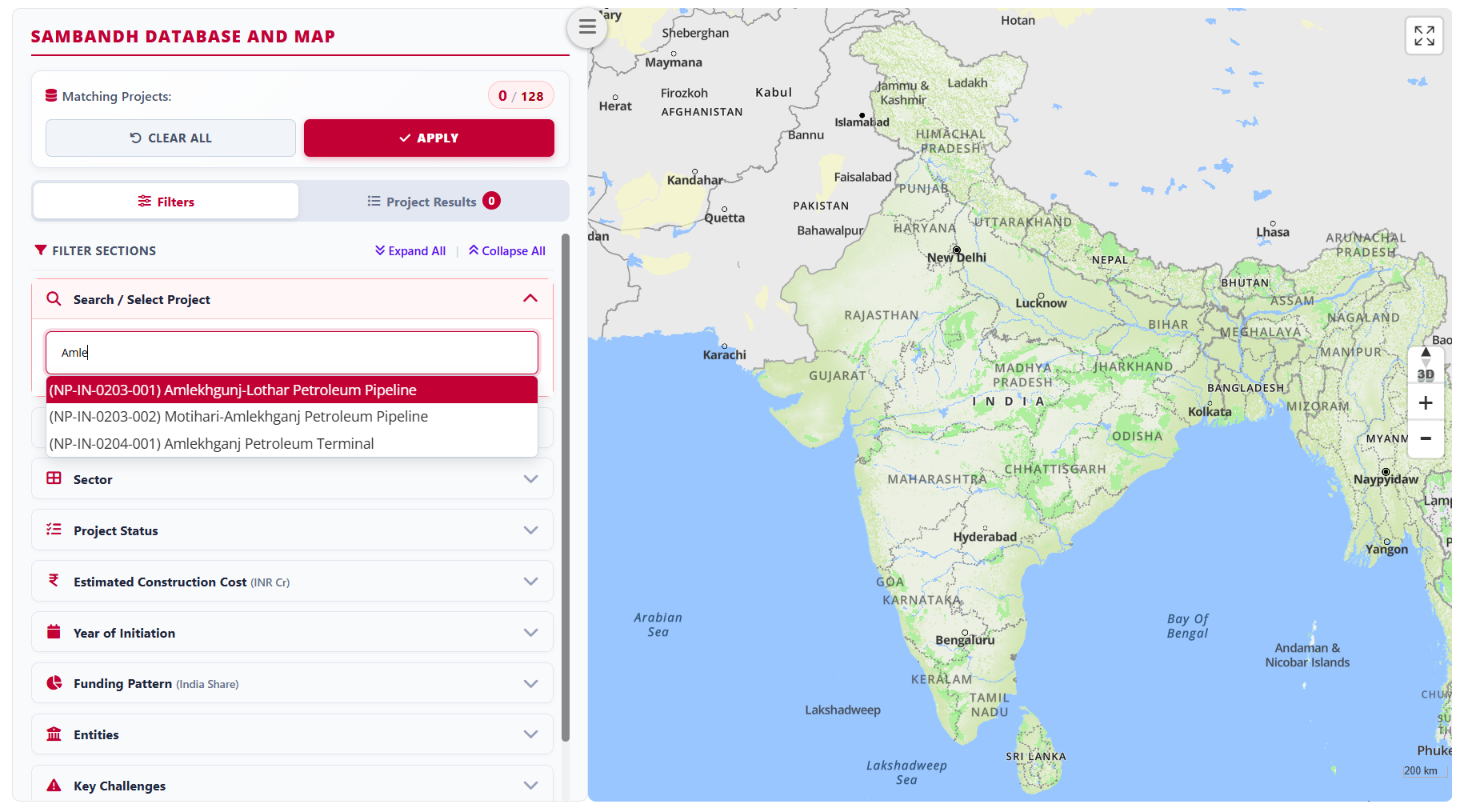
Filter 1: Search / Select Projects
Open the filter and scroll through the list to select one or more projects.
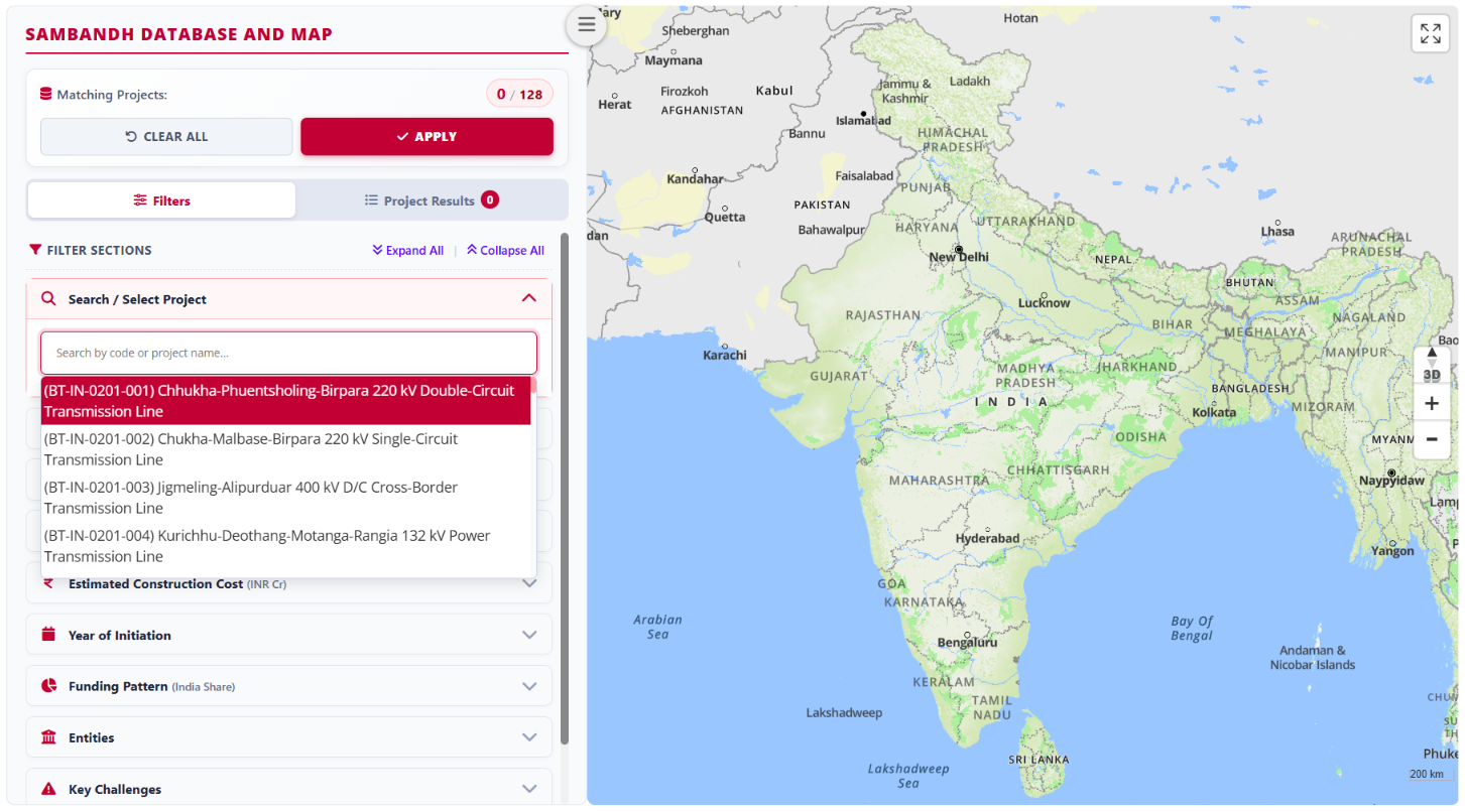
Search for one or more projects using their unique project codes.
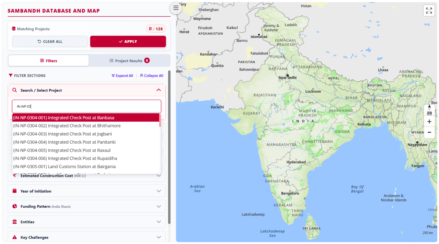
You can also search for projects by name.
Filter 2: Countries
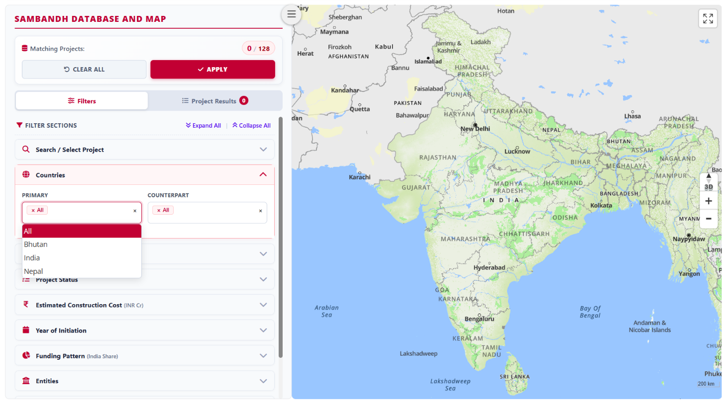
Select projects by their primary and counterpart countries. The primary country is where a project is primarily located or hosted. “All” is selected by default. Clear this selection to choose one or more specific countries.
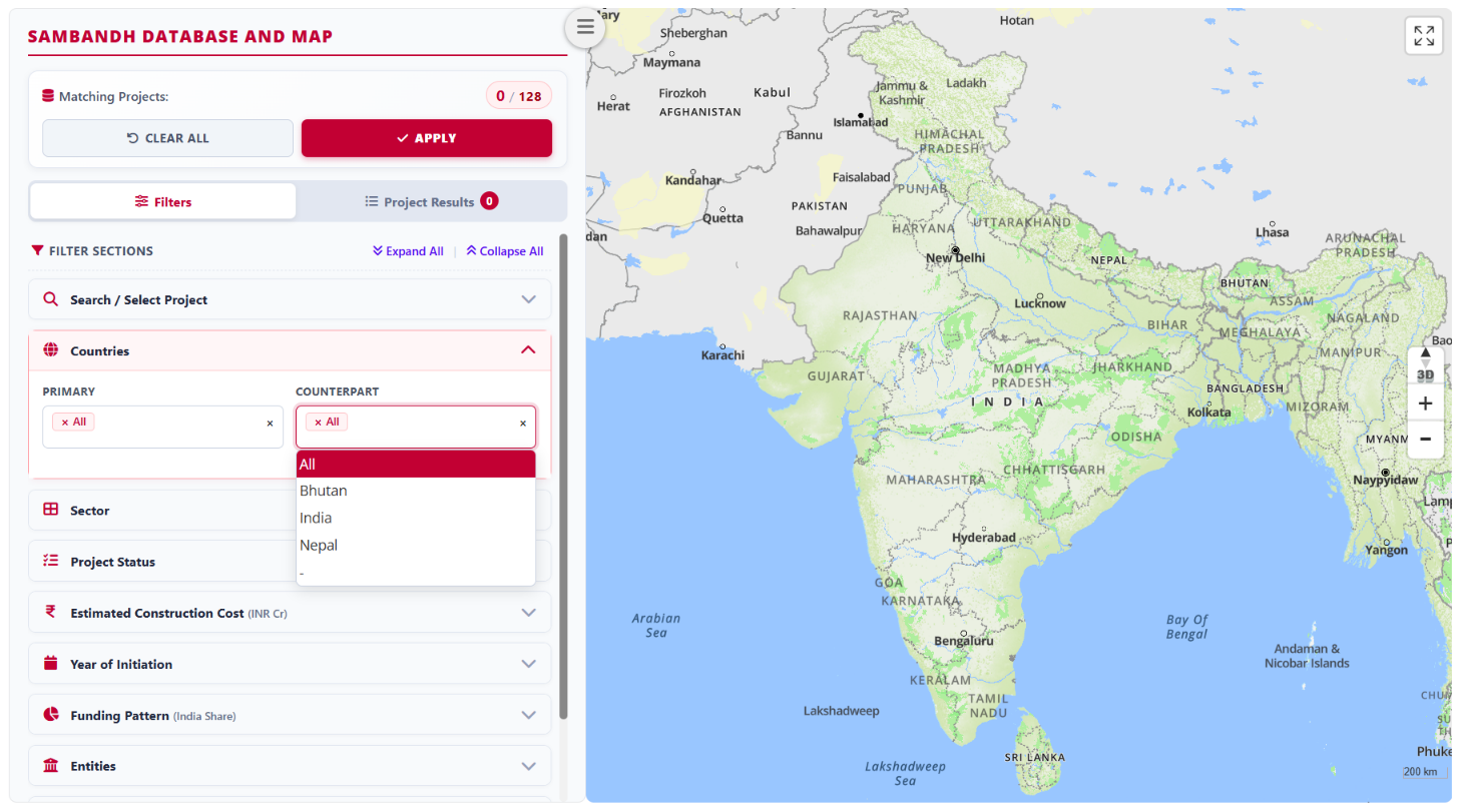
The counterpart country is the second country involved in a project. “All” is selected by default. Clear this selection to choose one or more specific countries.
Filter 3: Sectors and Sub-Sectors
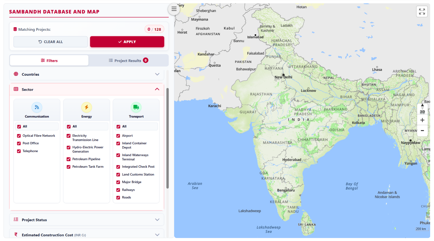
“All” sectors are selected by default. Clear this selection to choose any combination of sectors and their sub-sectors.
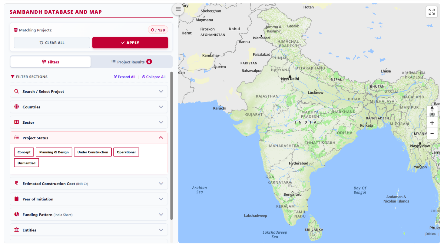
Filter 4: Project Status
Select any combination of the five status tabs: Concept, Planning and Design, Under Construction, Operational, and Dismantled. All tabs are selected by default. When you select “Apply”, the results include only projects classified under the selected statuses.
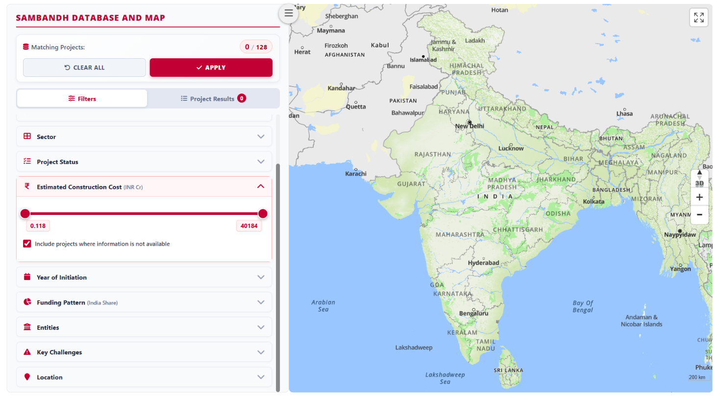
Filter 5: Estimated Construction Cost
Use the slider to select projects with estimated construction costs within your chosen range. You can also include or exclude projects for which cost information is unavailable.
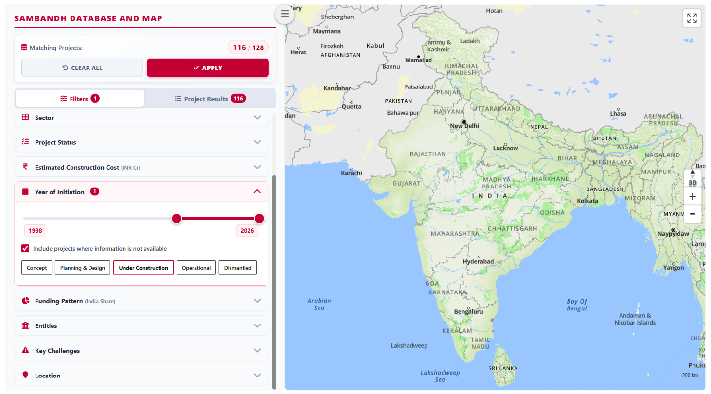
Filter 6: Year of Initiation
Use the slider to select projects whose initiation year for a particular project phase falls within your chosen range. You can also include or exclude projects for which this information is unavailable.
In the example shown, the selection includes projects that started construction between 1998 and 2026.
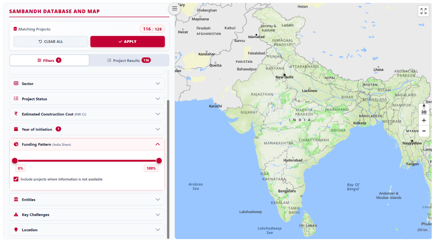
Filter 7: Funding Pattern
Use the slider to select projects where India’s share of funding falls within your chosen range. You can also include or exclude projects for which funding information is unavailable.
Filter 8: Entities
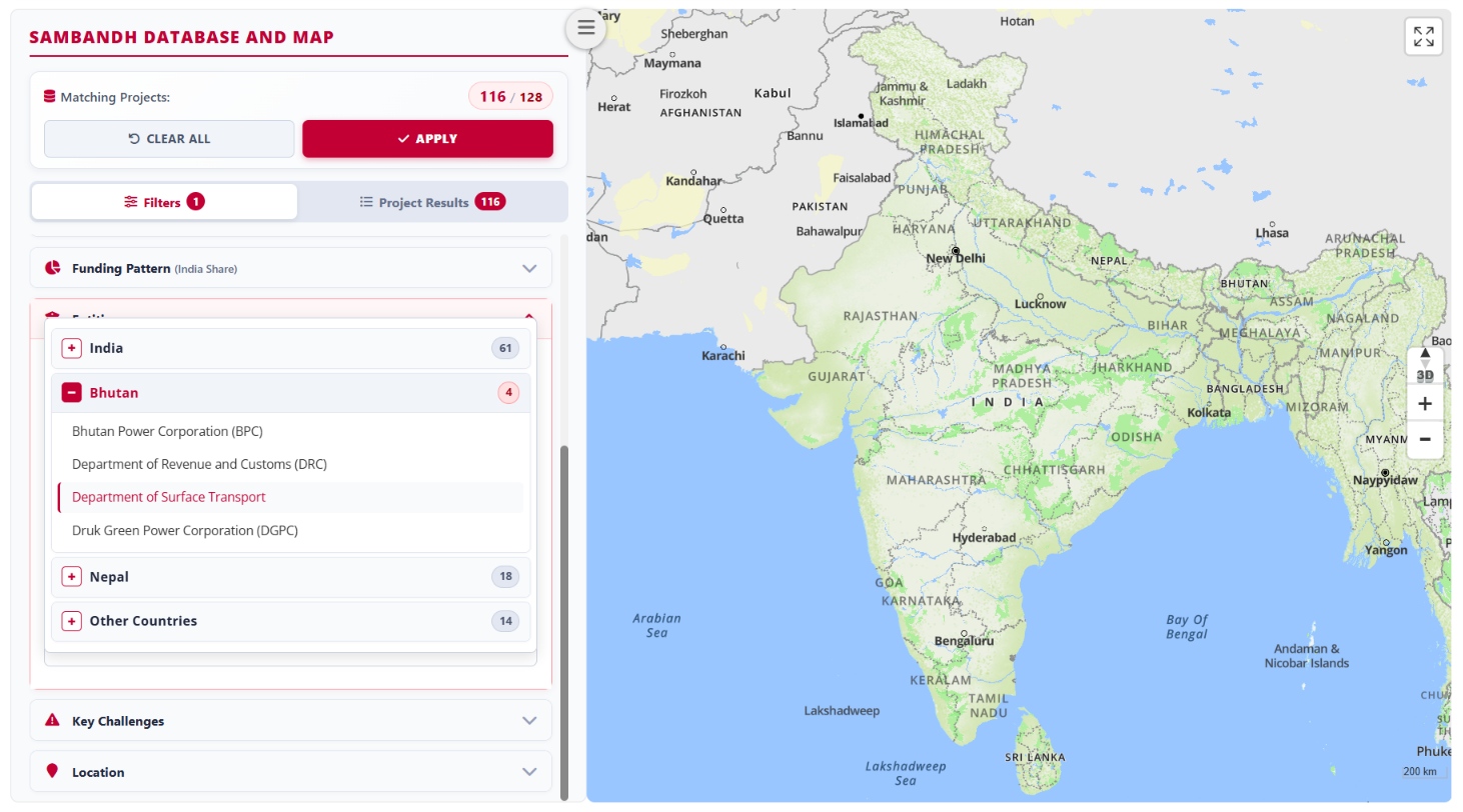
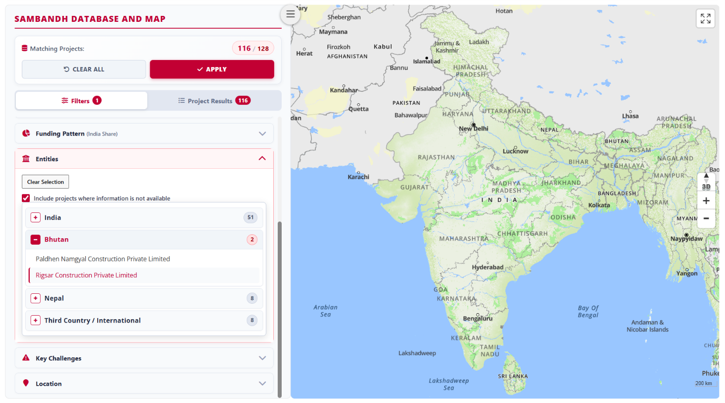
Select one or more project actors from the Ministries, Public Entities, and Private Entities categories. You can also include or exclude projects for which actor information is unavailable.
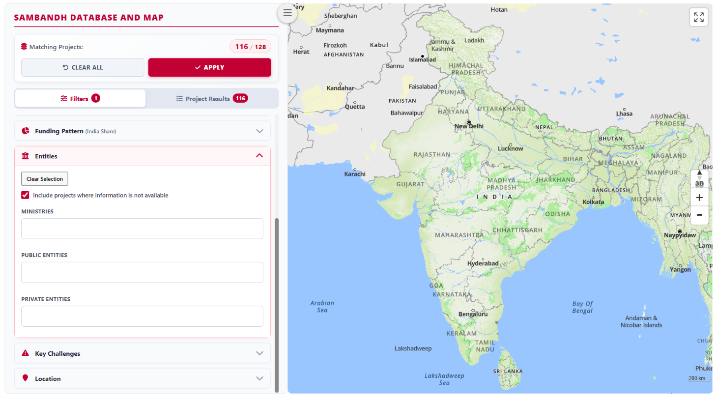
Ministries: Select one or more national-level ministries or departments for each country.
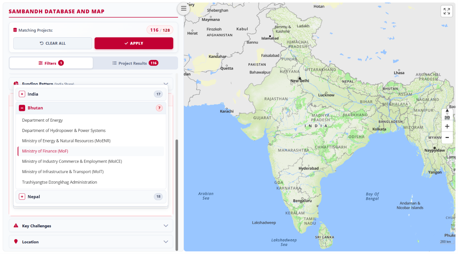
Public Entities: Select one or more government or quasi-government bodies involved in a project in each country, including executing agencies, public-sector organisations or undertakings, departments, divisions, and autonomous bodies.
Private Entities: Select one or more private-sector participants involved in a project in each country, including concessionaires, contractors, consultants, service providers, and financiers.
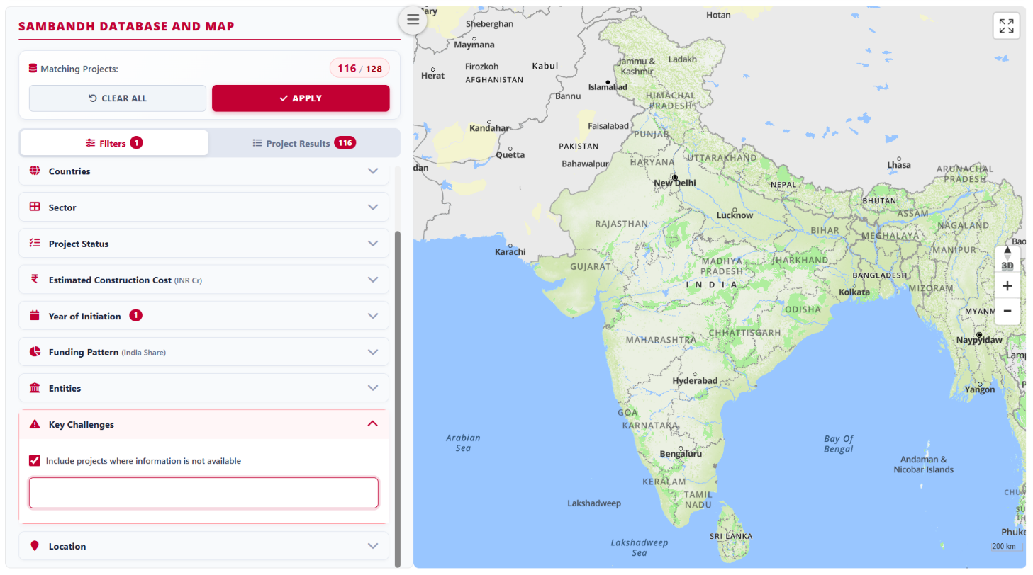
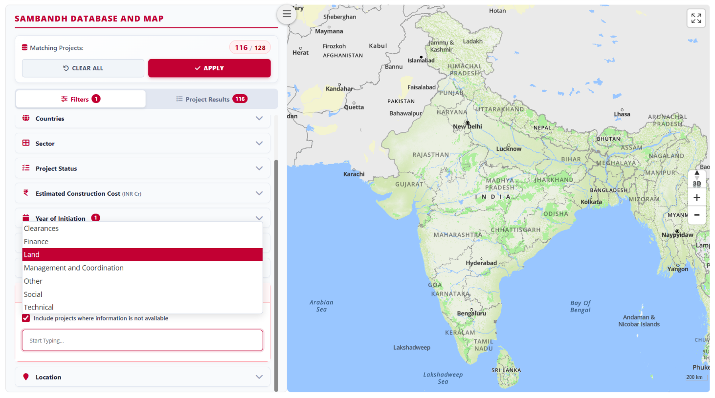
Filter 9: Key Challenges
Select projects by one or more recorded challenges in the following categories: Land, Clearances, Technical, Finance, Social, Management and Coordination, and Others. You can also include or exclude projects for which challenge information is unavailable.
Filter 10: Location
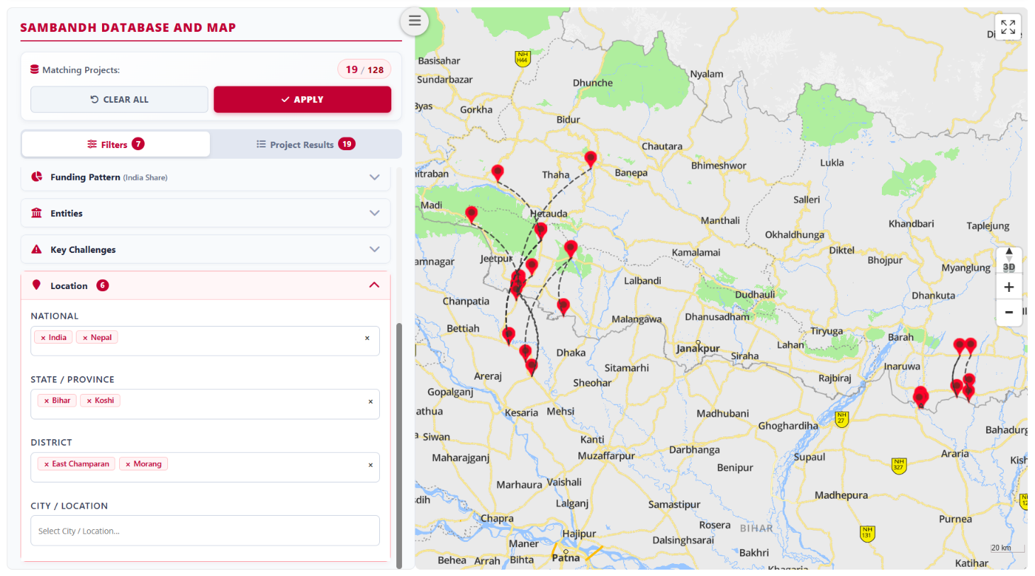
Filter projects by one or more geographic locations. You can combine selections across countries, states or provinces, districts or Dzonkhags, and cities or municipalities. Use this filter to visualise the concentration of connectivity projects in specific regions.
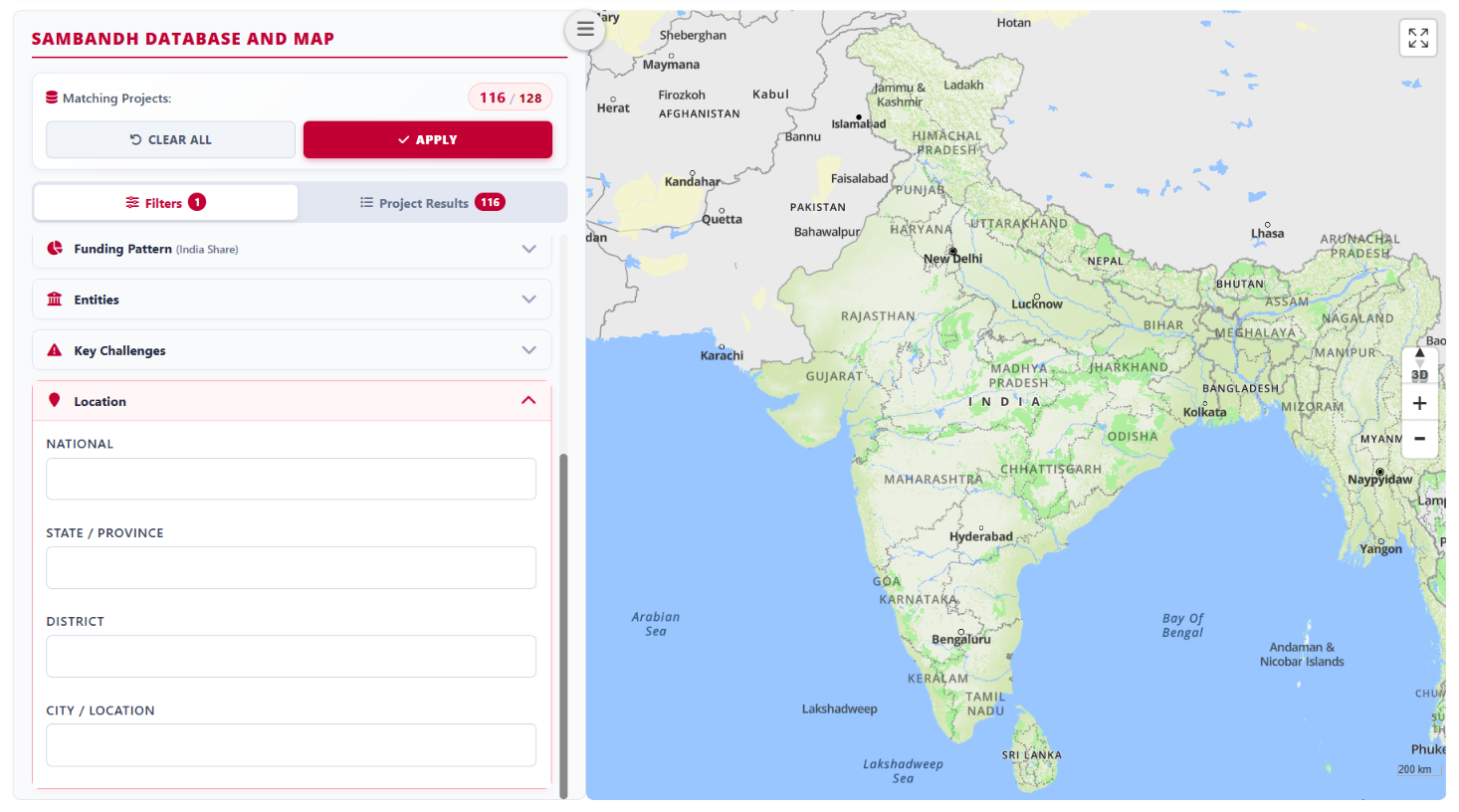
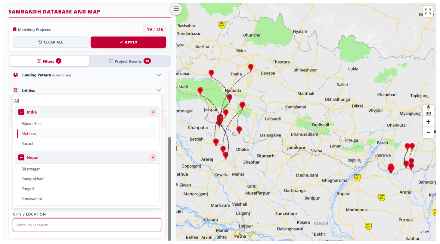
If you are unsure of the exact location, work through the nested filter structure. Start with a country, then select a state or province, followed by a district and a city or municipality. Each level displays only the locations within your preceding selection.
For example, selecting India displays only Indian states at the next level.
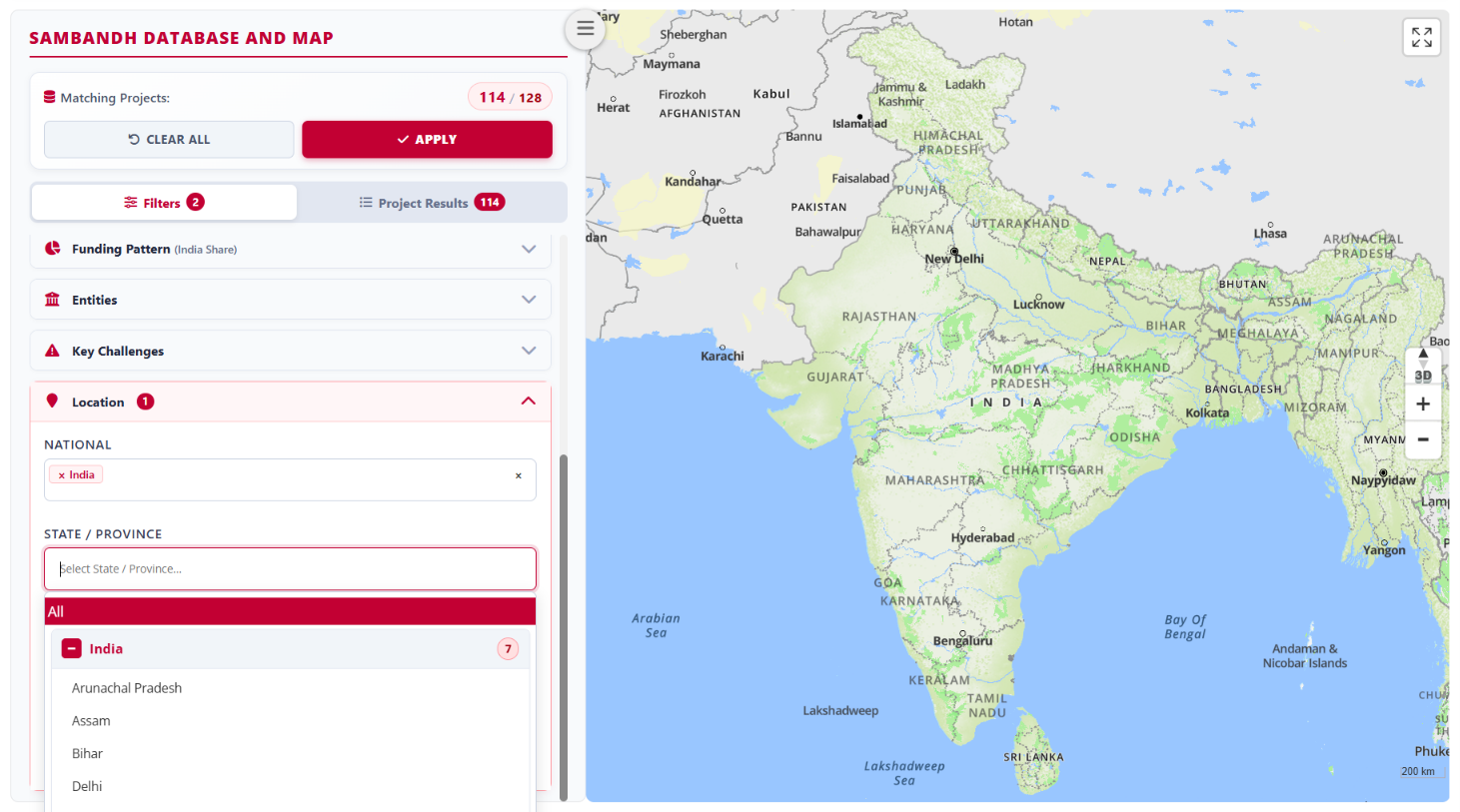
In the example shown, the selections are India > Bihar > East Champaran and Nepal > Koshi > Morang. East Champaran district offers three locations while Morang offers four locations at the next level.
3. Explore Project Results and the Map
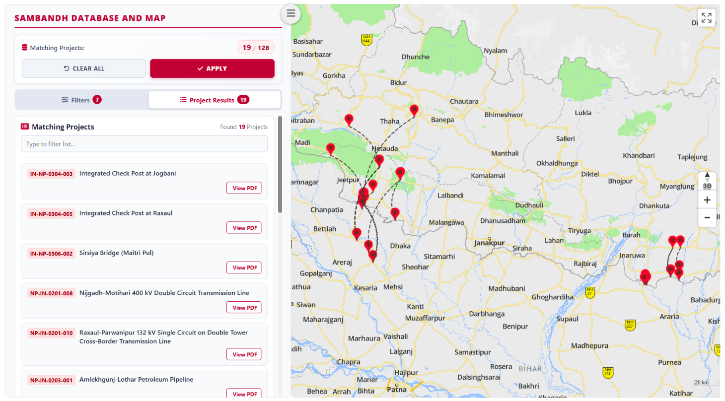
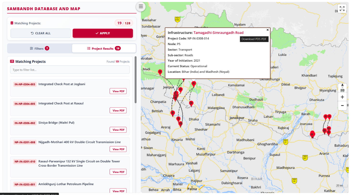
Once you have chosen your filters, explore the matching projects in two linked views: Project Results and the Map. Select “Apply” to switch to Project Results, which lists all matching projects. The map on the right displays their location pins, with dotted lines connecting location pairs within a project. Use the map’s zoom controls to explore the geography more closely.
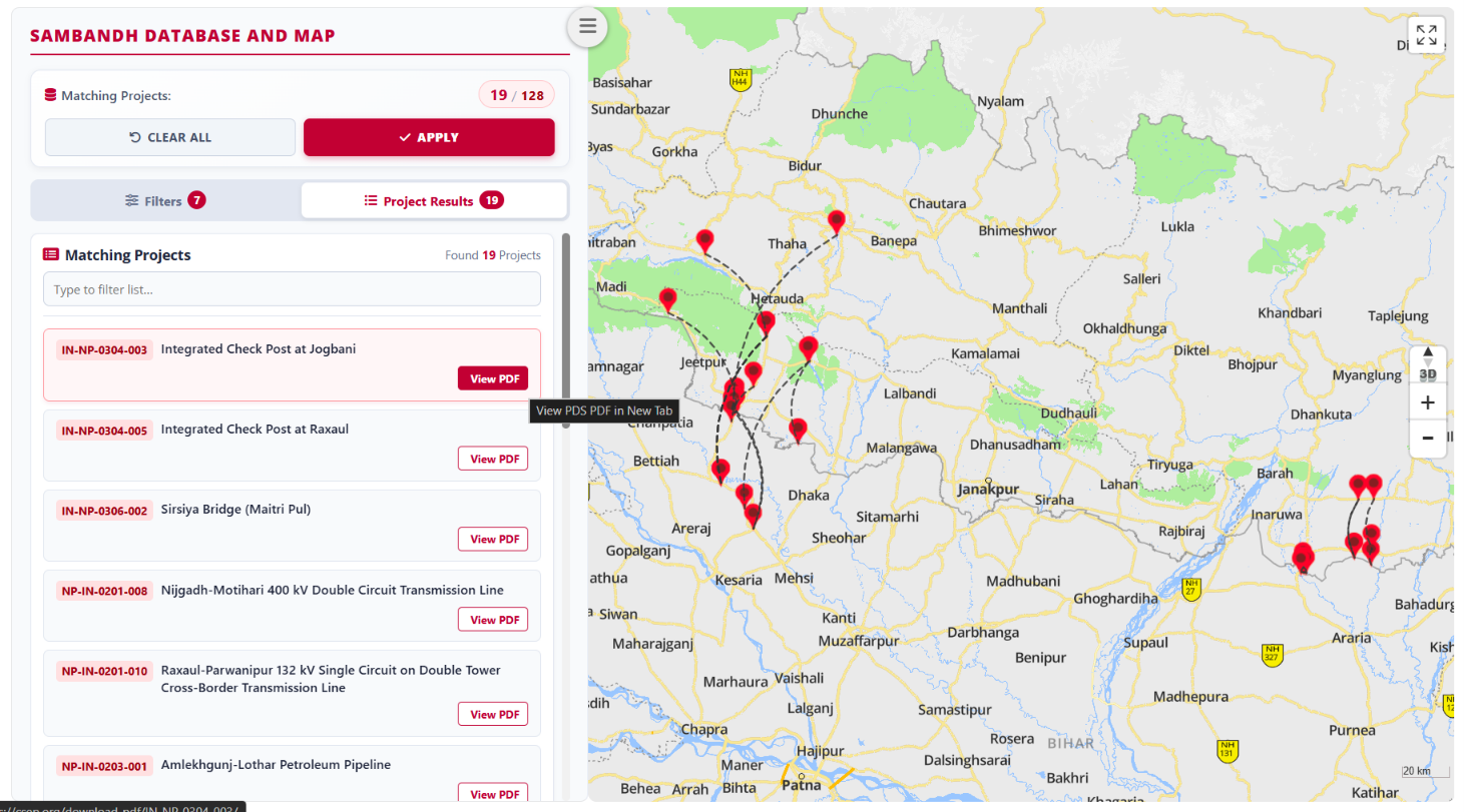
Scroll through the matching projects and select a project’s “View PDF” icon to generate its Project Data Sheet in a new tab, where you can download it.
You can also select a location pin to display a brief project card. Select the project name shown in red on the card to generate its Project Data Sheet in a new tab.
Example: Project Data Sheet generated in a new tab
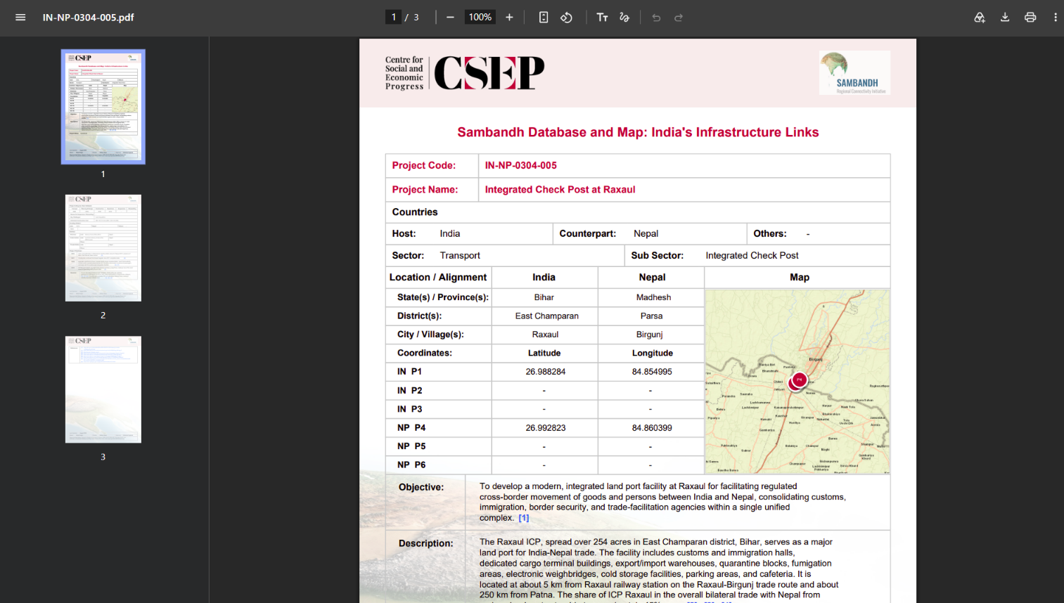
4. Reading the Project Data Sheet
Project Data Sheets (PDS) are dynamically visualised and auto-generated from the master database. Start by checking “Last Updated”, which gives the month and year of the project record’s latest update. Numbers in square brackets link to supporting sources. A dash (–) indicates that reliable information was unavailable for documentation; it does not mean zero or that an event did not occur. Read the project’s identity and geography first, followed by its status and lifecycle, costs and funding, participating entities, and timeline. Each structured project record covers:
- Unique Project Codes / Name
- Countries
- Sector – Sub-sector
- Location / Broad Alignment / Coordinates
- Objectives & Description
- Project Status and Key Challenges
- Cost and Funding Pattern
- Key Actors Involved
- Project Timelines
Interpreting the project fields
“Project Name” follows official documents wherever possible. Under “Countries”, Host identifies where the project is primarily located, Counterpart identifies the second country involved, and Others identifies a third country if involved. “Sector” and “Sub Sector” identify the project’s classification. “Location / Alignment” records states or provinces, districts, and cities or villages in India and the counterpart country. Coordinates give latitude and longitude for origin, destination, or intermediate points: P1–P3 within India and P4–P6 within the counterpart country. The map provides a visual reference alongside these details.
“Objective” explains what the project aims to achieve; “Description” gives a brief account of the project. Under “Entities”, Ministries lists national ministries and departments; Public Entities lists government and quasi-government agencies, public-sector undertakings, and autonomous bodies; Private Entities lists participants such as concessionaires, contractors, consultants, and financiers. Where relevant, Others identifies third-country participants or multilateral, trilateral, or bilateral bodies.
Use “Sources” to follow the numbered references supporting the project record, and read “Remarks” for additional context, history, assumptions, and limitations. Map locations may be approximate, and dotted lines illustrate connections between points rather than geographical routes. Maps are informational and educational, not official representations of international boundaries; independently verify information before official or critical use. The Maker compiled the dataset, the Checker checked and validated it, and the Approver checked, validated, and approved it. Use the PDS’s “Recommended Citation” when referencing the record, including its last-updated date, project code, and project name.
5. Change Your Selection
To explore a different set of projects, select “clear all”, choose your new filter options, and select “Apply” again.
